


Introduction & Service Offerings
GeoSpatial Innovation & Services prides itself on the ability to build long-term relationships based on trust and understanding with clientele and a reputation to match. We are passionate about what we do and confident in our ability to provide our clients with top quality service, bringing with us over 50 years of Caribbean experience with strategic global alliances. A multi-disciplined Geotechnical, Construction Project Management and Quantity Surveying firm, GeoSpatial Innovation & Services is committed to delivering world-class services to architects, engineers, owners, contractors, and financial institutions while maintaining the highest standards of quality. We look beyond our customers’ expectations to provide market-leading services. Safety, quality and productivity are important in every business and we are here to make sure your vision and ideas come to fruition.

Project Management Support
GeoSpatial Innovation & Services provides project management services through our construction program management teams. The construction program management team works closely with owners, engineers, architects, and construction consultants to ensure smooth integration between all phases of the construction process.

Quantity Surveying Support
At GeoSpatial Innovation & Services, a team of well-experienced, highly-trained expert quantity surveyors have in-depth knowledge of construction planning and design, programs, and costs will be there to assist you on your journey at every phase of the project. We offer quantity surveying services that can be tailored to meet your individual needs.
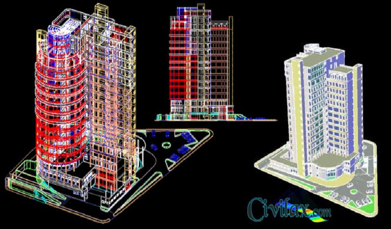
AutoCAD P & ID Drawing Support
GeoSpatial Innovation & Services employs the top AutoCAD & AutoCAD P & ID drawing experts to do the heavy lifting. We provide these services at competitive rates that will fit within your budget. Our team of experts is equipped with industry-leading software where they can create, alter and manage both schematic piping and instrumentation diagrams to include 3D plant designs, orthographic drawings, equipment, support structures, and data-centric P & ID systems.

Geographical Information Systems (GIS) Support
GeoSpatial Innovation & Services has mastered the art of Geographical Information Systems (GIS) support. Equipped with cutting-edge technology and many years of project experience in the field, we are committed to delivering high quality service in a cost-effective manner. We believe in a collaborative approach in providing Geographical Information Systems support to a wide array of businesses and industries.
Get a Qoute
We provide a wide range of services. If you are looking for a quote for any specific service, contact us now.
Contact Now